Politics & Government
Los Gatos Installs 17 Flood Evacuation Signs
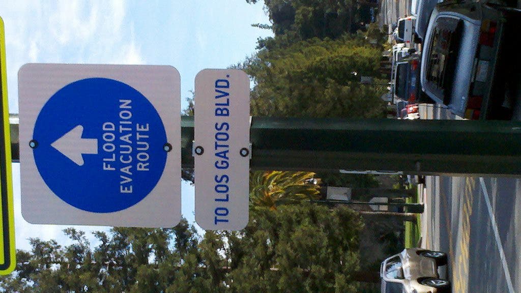
The warning boards have been posted on the east-west arterial routes of Main Street, Highway 9/Saratoga Avenue, Blossom Hill Road and Lark Avenue.


Los Gatos emergency officials announced this week they're nearing completion of their flood evacuation program through the installation of 17 escape route signs positioned in key spots around town during the past two weeks.
The signs, which cost about $1,000, would direct evacuees to safety by leading them to Los Gatos Boulevard on the east and North Santa Cruz Avenue/Winchester Boulevard on the west, said Los Gatos-Monte Sereno Police Sgt. Kerry Harris.
The signs were purchased with the town manager's emergency management budget and the poles, mounting hardware, and installation were paid for by Los Gatos Parks and Public Works monies, Harris said.
Find out what's happening in Los Gatoswith free, real-time updates from Patch.
The blue-and-white boards have been posted on the east-west arterial routes of Main Street, Highway 9/Saratoga Avenue, Blossom Hill Road and Lark Avenue.
Los Gatos developed the flood evacuation program to address the threat to public safety in the event Lenihan Dam at Lexington Reservoir, just minutes upstream from downtown, could fail if struck by major earthquake.
Find out what's happening in Los Gatoswith free, real-time updates from Patch.
Built in 1952, Lenihan Dam is maintained by the Santa Clara Valley Water District. It contains about 19,000 acre-feet of water.
Water district studies show that in the unlikely event of a catastrophic failure of the dam, with the reservoir at capacity, flood waters would reach Main Street in about six minutes and would inundate nearly all of the area between Los Gatos Boulevard and North Santa Cruz Avenue/Winchester Boulevard, Harris explained.
After a significant earthquake, the integrity of the dam would also be evaluated. If the safety of the structure was in doubt, the evacuation of the flood inundation zone could be ordered, Harris indicated.
Vasona Dam, at 400-acre feet capacity, represents less of a hazard to Los Gatos, officials said, adding that a catastrophic failure of the barrier would almost immediately inundate the portions of Los Gatos bordering to the border of the City of Campbell.
Evacuation announcements to the residents and businesses in the affected area would be made via public radio and television Emergency Alert System, Alert Santa Clara County reverse-911 system, by door-to-door contact by emergency response personnel or by vehicle-mounted public address systems, he noted.
Town officials also announced they have completed the following other aspects of the flood evacuation program:
- Water district dam safety personnel have trained on how to recognize and report post-earthquake dam damage.
- The town's Emergency Operations Plan has incorporated the flood evacuation plan annex, which establishes evacuations zones and routes, incident command procedures, logistics and coordination between town departments, outside organizations and mutual-aid agencies.
- The plan's final step involves a public awareness and education program of residents, businesses and organizations in the evacuation zone.
- The town will continue to work closely with the water district to ensure the community's safety "because while the likelihood of dam failure is extremely low, the consequences of such an event would be extraordinarily high," a press release stated.
Get more local news delivered straight to your inbox. Sign up for free Patch newsletters and alerts.


